Seller financing of land in Nova ScotiaOne of the most common questions I hear is “How does the seller financing work?” When it comes to purchasing land in Nova Scotia, particularly in rural or undeveloped areas, buyers may find traditional bank financing challenging to secure. This is where seller financing comes in as a useful alternative. In a seller-financed land deal, the seller essentially becomes the lender, allowing the buyer to pay for the land over time, directly to the seller, rather than securing a loan from a bank. 

How does Seller Financing Work?

Here’s how seller financing (sometimes called owner financing) typically works:

  • Agreement on Terms: The buyer and seller negotiate terms such as the interest rate, loan term, and any down payment required. These terms can be more flexible than those offered by traditional lenders.
  • Legal Documentation: A Purchase & Sale Agreement is created, outlining the buyer’s obligation to pay the agreed-upon amount, the loan term, the interest rate, and any conditions on their use of the land during the loan term. This document is legally binding, and both parties can involve legal representation to ensure everything is in order. You can find a sample purchase and sale agreement here.
  • Title Transfer: Typically the seller will retain the title to the property until the loan is paid off, at which point the deed is transferred to the buyer with the help of a lawyer. 

Seller financing can be structured in various ways, depending on the needs of both parties. In my case, I keep it simple:

  • I look at the current interest rates for the big banks and set a similar interest rate for the loan
  • I share a loan calculator (like this one from Lari.ca or this one from The Globe & Mail) with the potential buyer so they can look at the cost of payments over multiple timeframes (3 years, 5 years, etc.). Once they find a loan duration and a monthly payment amount that suits them, that gets recorded in the purchase and sale agreement
  • An initial downpayment is sometimes included
  • The agreement includes the ability for the buyer to make additional payments at any time in order to reduce the loan term
  • All payments are recorded in a shared online document, which also functions as a receipt for the buyer

Advantages of Seller Financing

Seller financing offers a range of benefits for both buyers and sellers, making it a flexible and appealing option for land transactions in Nova Scotia.

  1. Easier Qualification Process One of the biggest advantages of seller financing is that it’s often easier to qualify for than traditional bank loans. Buyers who may have difficulty securing financing through a bank—whether due to a lack of credit history, unconventional income, or other reasons—can still purchase land through a seller-financed deal. 
  2. Flexible Terms Seller financing allows for more customized terms than conventional loans. The buyer and seller can negotiate the interest rate, the size of the down payment, the length of the loan, and the repayment schedule. This flexibility can be particularly helpful for buyers who need creative solutions to make the purchase feasible. For example, a buyer and seller may agree on a smaller down payment or a longer repayment period, making the purchase more manageable for the buyer.
  3. Faster Transaction Because seller financing bypasses the need for bank involvement, the transaction process can be significantly faster. There’s no need to wait for bank approvals or jump through the hoops required by traditional mortgage providers. Once both parties agree on the terms, the deal can close quickly, allowing the buyer to take possession of the land without any delay. 
  4. Potential for Lower Purchase Costs By arranging a financial agreement directly between buyer and seller, the buyer can avoid paying realtor fees, resulting in savings that are typically reflected in the asking price of the land.

How to Structure a Seller Financing Deal for Land

When structuring a seller-financed deal for land in Nova Scotia, there are a few key components to consider. 

  1. Down Payment In some cases, sellers may ask for a down payment as a show of commitment from the buyer. This is negotiated as part of the Purchase and Sale agreement.
  2. Interest Rates In a seller-financed deal, the interest rate is often negotiable. It may be higher than the rate offered by traditional lenders because the seller is taking on more risk by financing the deal directly. However, with negotiation, buyers and sellers can arrive at a rate that is fair for both parties. Interest rates in seller-financed agreements can vary greatly, and they may be influenced by factors such as the size of the down payment and the length of the loan term.
  3. Term Lengths and Repayment Plans Seller-financed land deals often have shorter terms than traditional mortgages. Five years is a common choice, but it could certainly be more or less. Most seller financing agreements involve monthly payments of both principal and interest, similar to a traditional loan.

Seller Financing: Risks and Considerations

While seller financing offers flexibility and advantages, it’s important for both buyers and sellers to be aware of the risks involved.

For Buyers:

  • Higher Interest Rates: Interest rates in seller-financed deals may be higher than those offered by traditional lenders, making the purchase more expensive over time.
  • Default Risk: Most agreements will include wording about how missed payments are handled. That could involve additional interest costs for the buyer. In addition, many agreements will stipulate that if a payment is not received over a specific period (say, 6 months), the agreement is null and void. If you’ve paid off half of the property cost but can no longer make payments, you most definitely won’t own half the land – you’ll have nothing.
  • Lack of Traditional Protections: Without the involvement of a bank, some of the safeguards that typically protect buyers in traditional financing arrangements, such as a thorough vetting of the property through an appraisal process, may not be as rigorous.

For Sellers:

  • Misuse of Land: While a purchase and sale agreement typically includes provisions for how the buyer can use the land during the loan term, it is difficult to cover every scenario. Actions such as harvesting timber, or dumping waste on your land, can reduce the value of your property.
  • Management of Payments: Unlike a bank, the seller is responsible for managing and collecting payments over the course of the loan term.
  • Legal Considerations: A poorly structured agreement could leave the seller vulnerable to legal disputes or financial loss. It’s crucial to draft a well-constructed contract.

How to Find Seller Financing Opportunities in Nova Scotia

Seller financing opportunities may not always be advertised, so it’s important to know where to look and how to approach landowners who might be open to this arrangement.

  1. Working with Real Estate Agents Many real estate agents in Nova Scotia are familiar with seller financing and can help connect buyers with sellers who are open to this option. It’s a good idea to work with an agent who specializes in land transactions, as they will have the most relevant contacts and experience. If you are selling a property via MLS, you can have your realtor include details of seller financing options in the listing. You might need to persist on this point – some realtors very much prefer the ease and speed of the traditional lump-sum cheque that closes the deal.
  2. Online Land Listings and Classifieds Several online platforms specialize in land sales and may offer filtering options to find seller-financed properties. Websites like Kijiji, Facebook groups such as ‘LAND for sale in Nova Scotia’, private land sale websites, or even specialized real estate platforms for rural properties can be helpful.

Additional Costs with Seller Financing

There’s no magic method for avoiding the standard closing costs paid to Nova Scotia real estate lawyers for a real estate transaction. Having the deed transferred and registered involves a cost for both the buyer and seller. In my experience this ranges from $400 to $900 for the seller, and typically costs a bit less for the buyer. Here is what the lawyer provides: Preparation of warranty deed, preparing deed transfer tax affidavit, forwarding Warranty Deed to Land Registry Office, receipt of filed deed from Land Registry Office and delivery of report to client.

Example of a Seller Financing Deal

In this scenario, a buyer wants to purchase a 50-acre plot of undeveloped land in Cape Breton for $80,000:

  • Down Payment: The buyer negotiates a 10% down payment of $8,000 with the seller ($8,000).
  • Interest Rate: They agree on an interest rate of 6%.
  • Loan Term: The loan is structured over 7 years, with monthly payments of principal and interest. The monthly payment amount is $1,051.82
  • Cost of Borrowing: Over the 7-year term, the buyer will pay $16,352.54 in interest. That’s significant, but they will benefit from buying now in two ways: a) they’ve locked in the purchase price and any appreciation over the seven years will add to the value of their investment, and b) they can use the land immediately within the boundaries of their agreement
  • Legal Documents: A Purchase and Sale Agreement is drafted and reviewed by lawyers for each party. Once all payments are completed, the deed is transferred to the buyer. The buyer may use the land during the loan term as long as it’s in accordance to the terms of the agreement. 

This arrangement allows the buyer to purchase the land without going through traditional financing, while the seller benefits from earning interest on the loan over time.

Seller financing is an excellent option for buyers looking to purchase land in Nova Scotia. It provides flexibility, faster transactions, and an opportunity for buyers who may not qualify for traditional bank loans. However, both parties must carefully structure the deal, be aware of the risks involved, and seek proper legal and tax advice to ensure the transaction is successful and beneficial for both sides.


Dont forget! While seller financing is a useful means for obtaining funding for a land purchase in Nova Scotia, you’ll still want to follow all of the best practices on this site for finding high-value land. That includes topics such as: 


Nova Scotia GIS Maps: Never Get Lost Again

It’s that ridiculous, sticky-humid type of heat that has your shirt soaked in 15 minutes. Both mosquitoes and deerflies are swarmed around us, zooming in for bites. We’ve wandered through forest deadfall and thick brush full of thorny plants that tear your legs as you trudge through. And now, I realize, we’ve taken our first steps into a full-on marsh. After hours of this, Deb has nearly had it: “We’re lost, aren’t we?”


“Nooooo….” I say, holding my phone where she can’t see it and waiting for Google Maps to load. Damn, no signal.  I remember that day well – it was a frustrating one. And it’ll never happen to me again. 


For those in the know about the power of GIS maps combined with navigation apps, just roll your eyes and move on. But if you’re new to the topic, wow, this is a game-changer for anyone who loves to explore.


What Are GIS Maps?

Geographic Information Systems (GIS) maps are digital maps that capture, store, analyze, and display geographical data. Unlike traditional maps, GIS maps are dynamic and interactive. GIS maps are georeferenced – they align to real-world latitude and longitude coordinates. This alignment allows you to precisely pinpoint map locations and to layer various types of data such as property boundaries, topography, forestry characteristics, and a hundred other things. GIS maps are used by professionals in forestry, surveying, urban planning, and environmental monitoring. It was my connection with foresters and surveyors that got me chasing this one down – thanks fellas!


How GIS Maps Work

I could list the hundreds of data layers available, but let’s focus on those relevant to … buying land in Nova Scotia. First and foremost, the imagery – GIS maps provide some of the most detailed aerial and satellite photography available, period. You can see this in sites like Viewpoint and RemaxNova – look for “GIS” related options in the map layers. The difference between GIS imagery and Google Maps is often very significant. 


With the photography as your base layer, the next most important layer for landbuyers and owners is property boundaries. If you’re navigating a 100-acre lot, it’s kind of nice to know when you’re stepping onto the land of a neighbour, especially that guy who loves to drink a lot and go hunting.


And it’s really as simple as that. I also use the forestry characteristics, and you can find layers for wildlife characteristics (such as locating habitats of rare or endangered species), but for the most part, you just want to know where you are in relation to the specific Nova Scotia property you’re exploring.


But GIS maps are only half the equation. Having a nicely georeferenced PDF of a 100-acre Nova Scotia parcel of land is only useful if you’ve got a tool to pinpoint YOU on that map. 


Integration of GIS Maps with Navigation Apps

You want to have that GIS map – your georeferenced PDF file – loaded into a navigation app with offline navigation capabilities. I use Avenza Maps, and it’s been great to me so I haven’t needed to find any alternatives (I’m sure there are many). I’ll go into Avenza some more later in this post. Let’s get into how this stuff works…


GPS, or Global Positioning System, is a satellite-based navigation system that provides location information anywhere on Earth. GPS works by using a network of satellites that orbit the Earth. When you use an app like Avenza Maps, your smartphone receives signals from multiple satellites to calculate your exact position.


Your smartphone (with the right map and the right app) can connect to these GPS satellites to determine your location. Since the GPS signal is free and available worldwide, it allows your device to track your position without the need for cellular data or Wi-Fi. This is the game-changer I referred to earlier. With a bit of planning, no matter how remote you are and how spotty or non-existent the cellular coverage is, you need never get lost again.


Making the Complexity of GIS Maps Very Simple

This stuff can get pretty gnarly. The tools for viewing and outputting GIS maps are incredibly powerful, but not for the average user. Finding the right layers you want (such as Nova Scotia’s property boundaries) is tricky too. After kicking around at it for some time, I’m pleased to say I’ve got it down – at least as far as the basics that cover what I need, which is a highly detailed satellite image of the land I want to see, with a layer on top showing the property boundaries as they are registered in the Nova Scotia Property Online Registry.


So let’s make it simple. You need an app. You need a map. And once you connect the two you’re in navigation nirvana.


Step 1: Download Avenza Maps

Available for iOS and Android, this navigation app has everything I need, and more. You can use it for free with a limited number of active maps (three). Sure, over time you’re going to want to use more than three maps, but how many will you actively use at a time? The answer is usually one. When you reach your limit, simply delete a map you’re not using and add a new one. You can swap maps in and out endlessly.


Step 2: Download a Map

You can find maps by searching in the Avenza store in the app. Many are free. There’s a great map of Cape Breton Highlands National Park for example. Here’s a sample if you want to try one out – it’s a georeferenced GIS map for Kejimkujik National Park (the Park boundaries are not exact – I drew them in roughly as I could see them). I’ll write more about how to obtain GIS maps with property boundaries from the Nova Scotia Property Online Registry a bit further on, but here is an example of a GIS Map of a 100-acre lot in Cape Breton that has the property boundaries highlighted.


Step 3: Load your Map in Avenza

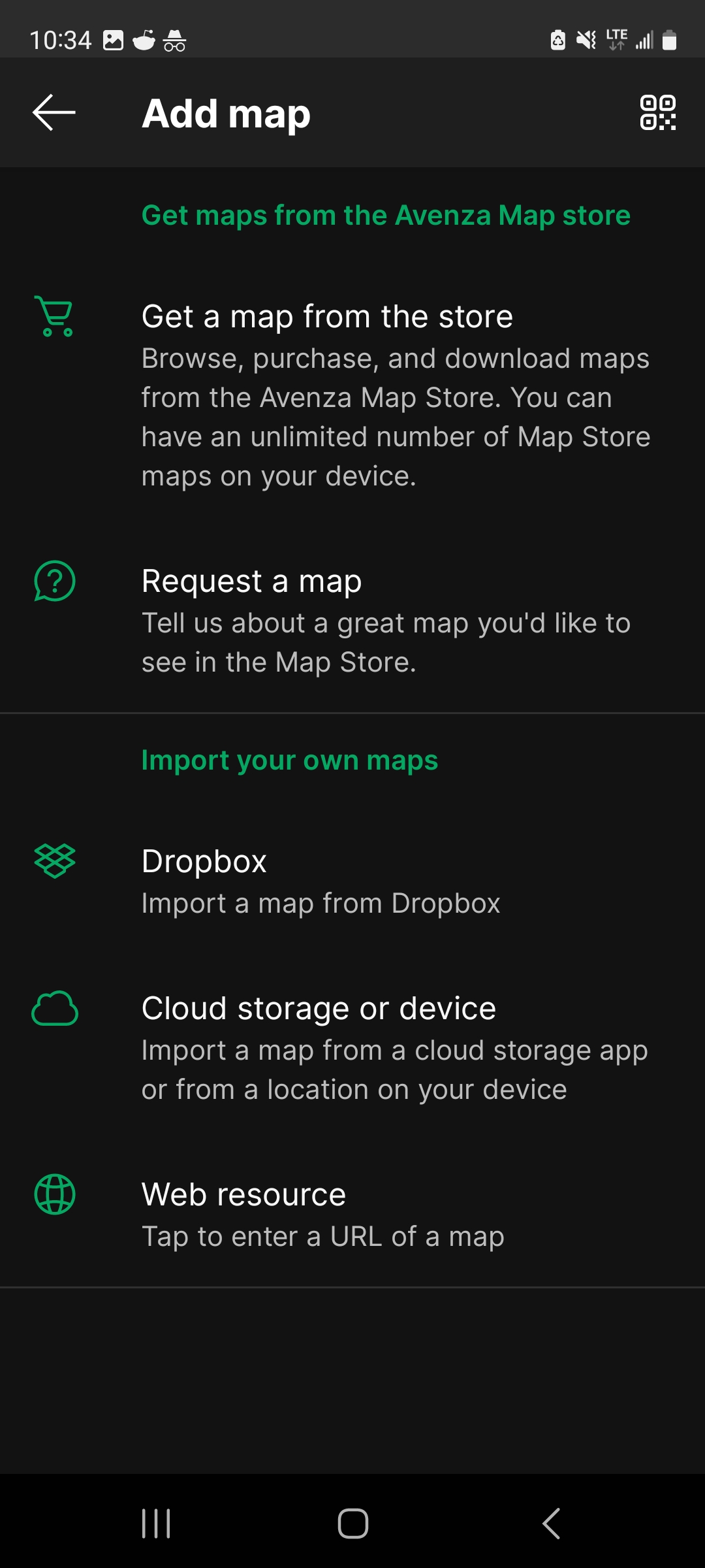
The Avenza interface is pretty intuitive. Click on “My Maps” and you’ll see a large orange + symbol in the lower right. Click that to add a map. Among the options you’ll see “Download or import a map”. On the next screen you’ll see several options for obtaining maps.

I keep it simple – I always store my GIS maps in a folder on my Google Drive. So I just need to click “Cloud storage or device” and then I can navigate in my Google Drive to that folder and select the map to load. That’s it! Once the  map loads, you’re ready to navigate.


Navigating your GIS Map in Avenza Maps

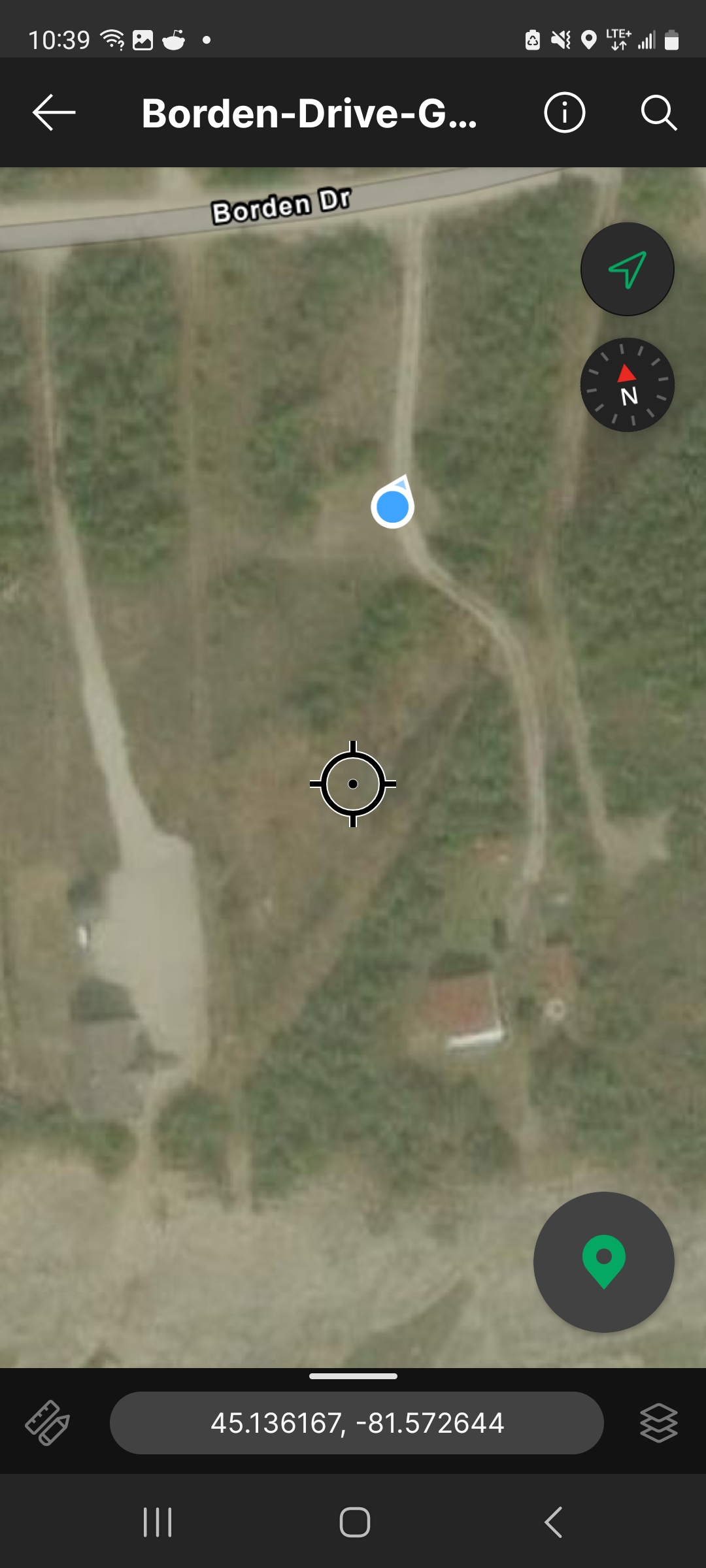
If you are in the vicinity of the map you loaded, you should have no trouble seeing a blue dot that represents your location. If you’re out of range (e.g. driving toward the location), you’ll need to get closer. Now, there are a wide range of options, settings, and calibration methods for an app like Avenza Maps. I’m no expert in these and I’m sure you can learn a lot from the software’s documentation. But here’s the thing – I haven’t needed to adjust or reset a single thing – it has always worked automatically and perfectly for me.

(Here’s a screenshot of me – the blue dot – walking up the driveway of my cottage. Note that the satellite imagery is foggy here. Normally it’s crystal clear but you may sometimes be surprised to see fog or snow in the image that can limit visibility.)


Just one note of caution for a first-time user. When you see your location on the map (showing as a blue circle with a white outline, you’ll also notice an arrow pointing from it. You might naturally assume it’s pointing in the direction you’re facing, but my experience is it’s not really the case. I find I’m better off focusing more on the circle rather than the arrow – you’ll see very quickly which direction you’re headed once you start moving. The app is remarkably precise at monitoring your location.


How to get GIS maps for Nova Scotia

Finding what you’re specifically looking for – say a specific property ID (PID), along with the property boundaries as defined in the Nova Scotia Property Online Registry, can be a frustrating search. When you think you’ve found it, highlighting the property and exporting the map in the right format can be a headache too. I’ve endured, and it gets easier with practice. All that to say, if you’d like a georeferenced GIS map of a particular Nova Scotia location (possibly including property boundaries), contact me and I’ll help you out. Happy navigating!

While there is a section on applicable taxes in the Buyer’s Guide: How to Buy Land in Nova Scotia, the topic is worth a deeper dive. That is particularly true due to the recent increase in capital gains inclusion rates that became effective across Canada in 2024.

Deed Transfer Taxes

The most common tax to be aware of is the Municipal Deed Transfer Tax (MDTT). Municipal Deed Transfer Tax rates are set by each municipality, and generally range from 1.0% to 1.5% of the sale price of the property. At the bottom of the post, you’ll find the applicable MDTT rate for each municipality in Nova Scotia. Municipal Deed Transfer Taxes are collected on behalf of the municipality through Land Registration Offices when the deed is registered/recorded. 

Provincial Non-Resident Deed Transfer Taxes (PDTT)

Here’s the fun part for out-of-province buyers. As of April, 2022, property buyers who are not residents of Nova Scotia must pay an additional 5% in deed transfer tax. This is in addition to the municipal deed transfer tax. The PDTT applies to all residential properties with 3 dwelling units or less, including vacant land considered to be residential property.

NOTE: the PDTT will be 5% in most cases, but it is actually the greater of the assessed value of the property, or 5% tax on the sale price of the property. 

Capital Gains Tax

When selling vacant land, capital gains tax may apply. The difference between the sale price and the original purchase price, minus any eligible expenses, is considered a capital gain. This tax is not part of the purchase and sale process; instead, it’s a requirement as part of the tax return filing of the seller. Capital gains are reported at tax time using Schedule 3, Capital Gains (or Losses).

There are some exemptions. If you’re selling your principal residence – the home you live in – you are exempt from capital gains. But if it’s a second home, a cottage, or just a big ol’ parcel of land you own, you’re on the hook for capital gains.

When you complete the Schedule 3, you’ll enter your original purchase price, sale price, and any eligible expenses including selling and closing costs. The resulting gain after those deductions is what you’ll pay tax on. The tax rate on your first $250,000 of capital gains in a calendar year is taxed at 50%. Any amounts above that are taxed at 67%. For a quick calculation of how much tax you may owe, try the Capital Gains Tax Calculator from Lari.ca.  


Taxes Due to an Estate on Death

I’m going to touch on some possible tax events to your estate in the event of your death. Sorry to get morbid, but I do think there’s a real awareness gap here. Land is a funny type of asset. In many cases, it’s passed on to family through the generations. Meanwhile, the value of that land is increasing and, in the event of death it can trigger … you guessed it… capital gains tax. 


Upon the death of the owner, the property is deemed to be disposed of at its fair market value. Any resulting capital gain must be reported on the final tax return of the deceased, potentially leading to a significant tax bill. The land can be transferred to a surviving spouse if one exists – this basically defers the tax until a future date when the surviving spouse passes away.


To give a quick example, in 1990, Paul inherits a 250-acre woodlot from his parents. Taxes are all paid up by the time the deed transfer is completed, so Paul was not impacted by that and didn’t need to get involved. He spends decades enjoying the woodlot and trails with his family. Meantime, the market is driving real estate prices much higher in the area. Fast forward to today and Paul has passed away. Diving into his estate, his son is shocked at the extent of the capital gain on that land.

  • Original market value (1990): $40,000
  • Current market value (2024): $350,000
  • Capital gain tax payable: $165,020

Effectively, the cost of keeping that land in the family is $165,020 which will be deducted from the assets of Paul’s estate and significantly reduce the funds that his son inherits. These are just pretend figures of course, but I feel this scenario is quite real for many people who may not be aware of the implications. 

There are estate planning strategies that might help you reduce the ultimate tax bill if you have substantial land assets. Those are beyond my scope of advisement and I’d recommend talking to a good financial planner or accountant.

GST/HST on Sales of Vacant Land

I’ve written on this topic in the Buyer’s Guide: How to Buy Land in Nova Scotia, so I won’t duplicate that here. In a nutshell, if the land being sold is owned by an individual and was used solely for personal use, GST/HST does not need to be charged or collected from the seller. There are nuances to this including land that has been subdivided into multiple portions. For a good source straight from the Government, read the info here

Property Taxes on Nova Scotia Land

Of course, for any owner of Nova Scotia land, there are property taxes to be paid each year. I’ve written a fair bit about how property is valued and the impact on your taxes in my post called Your Property Assessment and Nova Scotia Property Tax.


To wrap up this topic, you will find the list of Nova Scotia municipal deed transfer tax rates below. And here are links to other topics on buying land in Nova Scotia that might interest you:

Municipal Deed Transfer Tax Rates

This data is current as of July, 2024. Municipal tax rates can change over time. For a current snapshot, visit the Provincial website

County Municipality Rate Payable at LRO
Annapolis Municipality of the County of Annapolis 1.5% Kentville
Annapolis Town of Annapolis Royal 1.5% Kentville
Annapolis Town of Middleton 1.5% Kentville
Antigonish Municipality of the County of Antigonish 1.0% Amherst
Antigonish Town of Antigonish 1.5% Amherst
Cape Breton Cape Breton Regional Municipality 1.5% Sydney
Colchester Municipality of Colchester 1.5% Amherst
Colchester Town of Stewiacke 1.0% Amherst
Colchester Town of Truro 1.0% Amherst
Cumberland Municipality of the County of Cumberland 1.5% Amherst
Cumberland Town of Amherst 1.25% Amherst
Cumberland Town of Oxford 1.5% Amherst
Digby Municipality of the District of Clare 1.0% Kentville
Digby Municipality of the District of Digby 1.0% Kentville
Digby Town of Digby 1.5% Kentville
Guysborough Municipality of the District of Guysborough 1.0% Sydney
Guysborough Municipality of the District of St. Mary’s 1.25% Sydney
Guysborough Town of Mulgrave 0.5% Sydney
Halifax Halifax Regional Municipality 1.5% Halifax
Hants Municipality of the District of Hants East 1.5% Kentville
Hants West Hants Regional Municipality 1.5% Kentville
Inverness Municipality of the County of Inverness 1.5% Sydney
Inverness Town of Port Hawkesbury 1.5% Sydney
Kings Municipality of the County of Kings N/A N/A
Kings Town of Berwick 1.0% Kentville
Kings Town of Kentville 1.5% Kentville
Kings Town of Wolfville 1.5% Kentville
Lunenburg Municipality of the District of Chester 1.5% Bridgewater
Lunenburg Municipality of the District of Lunenburg 1.25% Bridgewater
Lunenburg Town of Bridgewater 1.5% Bridgewater
Lunenburg Town of Lunenburg 1.5% Bridgewater
Lunenburg Town of Mahone Bay 1.5% Bridgewater
Pictou Municipality of the County of Pictou 1.0% Amherst
Pictou Town of New Glasgow 1.0% Amherst
Pictou Town of Pictou 1.0% Amherst
Pictou Town of Stellarton 1.0% Amherst
Pictou Town of Trenton 1.0% Amherst
Pictou Town of Westville 1.0% Amherst
Queens Region of Queens Municipality 1.5% Bridgewater
Richmond Municipality of the County of Richmond 1.5% Sydney
Shelburne Municipality of the District of Barrington

1.5%

Real estate investors in any part of the world are looking for the same thing: under-valued real estate investments with high upside potential. And if you’re not looking at Canada’s Atlantic coast as a promising opportunity, you might be missing out  In particular, I feel Nova Scotia’s land market has the most to offer. Here’s 8 reasons why:

01

Canada is closed to foreign home buyers

The Prohibition on the Purchase of Residential Property by Non-Canadians Act effectively shut the door for foreigners looking to purchase residential property in Canada for all of 2023 and 2024. But guess what’s exempt? Land! Foreign investors can buy all the land they like, and build houses on it too. For foreigners who want to invest in Canada’s lucrative housing market, it’s as simple as buying raw land with development potential, and then build, baby, build!

Next, let’s look at why Nova Scotia is a particularly great place to invest…

02

Nova Scotia has some of the cheapest land per acre in Canada

While we’re not necessarily buying farmland, the farmland values index from Statistics Canada is a useful measure of the relative value of acres in each province. The data shows that an acre of farmland in Nova Scotia averages $3,913, lowest among the Maritime provinces and second only to the Prairies.


Province

Average cost of land/acre – 2023 (CAD)

Ontario

$19,685

British Columbia $10,056
Quebec $9,964
Newfoundland / Labrador $8,642
Prince Edward Island $6,452
New Brunswick $4,340
Nova Scotia $3,913
Alberta $3,728
Manitoba $3,439
Saskatchewan $2,384

Next, looking at the growth of land prices by province from May 2020 to May 2024, the Atlantic provinces of PEI, Nova Scotia, New Brunswick, and Newfoundland/Labrador really stand out. While other regions have seen dramatic growth in land values, the East Coast is holding steady at affordable prices. For anyone looking to buy low, now is the time.


Province Land Cost Increase (05/2000 to 05/2024)
Quebec 17.35%
British Columbia

12.93%

Ontario

11.63%
Prairie Region 6.57%
Atlantic Canada 2.08%
Canada (Average)

11.23%

Source: Statistics Canada


03

Homes are selling at record-high prices in Nova Scotia

Sure, you’re just buying land, but residential housing figures are important for determining the potential value of the land once developed. The second column in the table below lists the average selling price of homes by province based on May, 2024 data. The third column compares home prices with land prices to show how many acres of land one could buy based on the average selling price of homes in that province. The higher the number the better, indicating you can buy land that, if developed, will pay off more richly than it would in other areas. Nova Scotia’s numbers are near the top, second only to the prairie provinces of Alberta and Saskatchewan. But don’t head for the Prairies based on that data. Read on for more reasons why Nova Scotia is by far our number 1 choice.


Province

Avg. cost of land/acre – 2023 (CAD)

Avg. home price – May, 2024 (CAD)

Home Price / Land Cost Ratio
Ontario

$19,685

$890,634 45.2

British Columbia

$10,056

$1,001,736

99.6
Quebec

$9,964

$498,124 50.0
Newfoundland / Labrador

$8,642

$306,184 35.4
Prince Edward Island $6,452 $391,819 60.7
New Brunswick

$4,340

$338,740 78.1
Nova Scotia $3,913 $464,661 118.7
Alberta $3,728 $507,706 136.2
Manitoba $3,439 $371,224 107.9
Saskatchewan $2,384 $328,029 137.6

04

Nova Scotia is growing fast, with a bold pledge to reach 2 million residents

In 2021, Nova Scotia’s provincial government launched its Population Growth Strategy, setting a goal of reaching the 2 million mark by 2060. To reach this target, Nova Scotia will have to welcome 25,000 newcomers every year going forward. The program started well, with over 60,000 newcomers to Nova Scotia in the first two years. In Nova Scotia, you have a clear population growth mandate, backed intensely by the government and with programs to support it. All of those newcomers will create an increasingly competitive market for land and housing – exactly the type of demand that drives price increases.

  Population (May 2020)

Population (May 2024)

Growth Rate
Canada (Avg.) 38,006,941 41,012,563 7.91%
Prince Edward Island 158,401 177,081 11.79%

Alberta

4,405,455

4,849,906 10.09%
Yukon

41,807

45,750 9.43%
British Columbia 5,169,535 5,646,467 9.23%
Nova Scotia 986,204 1,072,545 8.75%
New Brunswick 782,512 850,894 8.74%
Ontario 14,752,374 15,996,989 8.44%

Manitoba

1,379,280 1,484,135 7.60%
Quebec 8,550,900 9,030,684 5.61%
Saskatchewan 1,169,038 1,231,043 5.30%
Nunavut 39,137 40,758 4.14%
Newfoundland / Labrador 527,733 541,391 2.59%
Northwest Territories 44,565 44,920 0.80%

Source: Statistics Canada

05

Housing in Nova Scotia is already in drastically short supply

  1. What do all those newcomers to the province need? A roof over their heads would be a great start. A 2023 study by consultant Turner Drake & Partners found that Nova Scotia will be short 41,200 homes in less than five years, and the shortage in housing units could reach 80,400 within 10 years. So, let’s add up a few observations on the Nova Scotia real estate market so far: 
    1. It has some of Canada’s cheapest land available, which can be purchased by any foreign resident
    2. Houses are selling for over half of a million CAD on average
    3. The population is growing rapidly with a goal of doubling residents by 2060
    4. It’s expected the province will be short about 80,000 homes within 10 years

When you add all these factors together, it creates a pretty compelling case for foreign investors.

06

Nova Scotia has breathtaking scenery and beautiful coastlines

Remember comparing land values with the Prairie provinces earlier? Consider that in Nova Scotia you can find cheap land that has ocean views, mountain trails, streams, forests, or access to one of thousands of beautiful lakes. You can find that in British Columbia, but you’ll likely pay 5 times as much per acre. Having gorgeous scenery that adds to your land’s market value gives land buyers a wider variety of options based on the specific features they are looking for.

07

The weather in some areas of Nova Scotia is far more pleasant than you may think

There are different micro-climate areas areas all over the province, but if you’re dreading harsh Canadian winters you may be in for a nice surprise. Nova Scotia’s South Shore area, extending from Halifax to Shelburne, has quite mild winters compared to the harshness many Canadians endure.

While it might seem silly to compare Nova Scotia’s climate with California’s, have a look at the monthly average high/low temperatures of Shelburne, NS as compared to San Francisco, CA. A colder winter to be sure, but the temperature differences are far less than one might expect.

  Shelburne, NS
San Francisco, CA
January 1° / -9° 14° / 8°
February 1° / -9 16° / 9°
March 5° / -4 17° / 10°
April 10° / 0° 18° / 11°
May 16° / 5° 19° / 12°
June 21° / 9° 19° / 12°
July 24° / 12° 19° / 12°
August 24° / 13° 20° / 13°
September 20° / 8° 21° / 13°
October 14° / 3° 21° / 13°
November 9° / 0° 18° / 11°
December 3° / -6° 14° / 8°

08

Nova Scotia has an abundance of natural resources that fetch a premium in other places

As our world continues to face the strain of sustaining our population, some of the most fundamental resources that we take for granted stand to increase in value. Construction engineers are learning that using mass timber for construction instead of concrete can dramatically reduce the greenhouse emissions for new buildings. Water is becoming increasingly polluted in some areas, requiring more expensive treatment or the need to import from a cleaner source. And environmental scientists are finding new uses for age-old resources that previously had little value, such as that sea kelp you find all over beaches on the Nova Scotia coast. For most local and foreign investors, it comes back to one basic resource: trees, trees, trees. With some education and good silviculture processes, even a small stand of trees can become a viable income source. Investors who eye long-term investment growth will get it – it’s like slow-motion farming – each year that your trees grow they increase in value. To learn more about woodlot investing, visit our post on Nova Scotia Woodlot Management.


Why Wait?

Don’t let today’s opportunity be tomorrow’s regret. There’s a compelling case for foreign investors to buy land in Nova Scotia. 

If you’re looking for a place to start, try our free Buyer’s Guide: How to Buy Land in Nova Scotia. Or explore the site for tips on land development, conducting title searches, access to zoning maps and land use bylaws, and so much more.

Lake Ainslie - waterfront land for sale

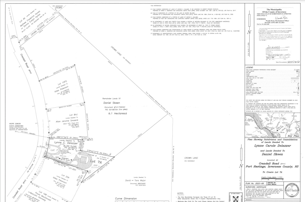
A Land Survey is your official “map” of your Nova Scotia land

“Is it surveyed?” is a common question that comes up when buying land in Nova Scotia, or anywhere really. While a survey isn’t essential, it’s the surest way to fully understand the boundaries of a property. And for certain activities like subdividing land, it’s essential. In this post we’ll dive into the ins and outs of surveying land, and include a list of Nova Scotia surveyors for each region.

A land survey to confirm property rights

If you’re buying or owning property in Nova Scotia, getting a land survey can help you protect your investment. The work of a surveyor produces a detailed map that shows exactly where your property lines are, which is quite handy for avoiding any mix-ups with the neighbors. Typically you can see the surveyor’s work with your own eyes – in brush-covered areas they will typically cut (or “slash”) a clear trail along the boundary lines. As the landowner, it’s important to keep these boundaries cut. If you let the vegetation erase those trails, you’re losing some of the value of the investment in the survey.

In Nova Scotia, land can take on some strange dimensions. Narrow, long rectangular lots exist in many places. A 200-acre lot might be just 50-feet wide, so knowing where the property abuts the neighbour’s is important. And surveys don’t just mark out the boundaries; they also show where buildings and fences sit on your property, as well as existing rights of way or easements, which can be quite helpful if there’s ever a disagreement over land. 

In one instance I purchased property and later realized as I looked at a satellite map that there was a neighbour’s barn that was clearly encroached on my land. I did what I often do when predicaments arise – absolutely nothing – but luckily the owner reached out to me to resolve the problem. Part of the solution of course was a survey. Together we planned out some subdivision lines and engaged a surveyor to make it official. 

But it’s not just about solving disputes. Knowing the exact scope of your land is useful if you ever want to sell your place or build something new. Everyone involved gets to see the clear-cut lines, which makes everything smoother.

But again, a survey isn’t essential. I typically only get a survey done if there are important questions or issues to solve, or if there’s a development work that requires it such as subdivision. Another thing to explore is whether the property has been previously surveyed. Some surveys will appear in the Property Online Land Registry, but it’s not automatic that all surveys get added to that database. In the example I referenced earlier, I can go to Property Online and view the survey that was created to enable subdivision of the lot. In another example, a neighbour shared with me a survey that was done about 10 years ago – searching Property Online does not turn up that survey.

If you don’t have any luck turning up old surveys, you might be surprised how much you can observe from the land directly. Metal survey markers are often placed at the corners of property boundaries. One parcel I owned had markers on a few corners, a lakefront on another side, and a clear natural boundary (a stream) on the other. This made the boundaries pretty evident without the need of a survey. If you don’t need the official record of your property boundaries that a survey provides, you can do a pretty good job of walking the lines yourself using Nova Scotia GIS Maps – satellite maps that are highly detailed and can show a layer that includes property boundaries from the Nova Scotia Property Online Registry. I’ve got a separate post on GIS maps and using Avenza Maps to navigate – these are tools used by many surveyors. 

Nova Scotia Land Survey

Facilitating Real Estate Transactions

When it comes to buying or selling property in Nova Scotia, having a land survey can give the buyer some assurance that there are no discrepancies with the boundaries of the lot as seen on sites like Viewpoint or Property Online. A professionally created survey gives everyone involved a clear picture of what’s being dealt with, which can really speed things up and boost confidence in the deal.

I have had buyers include different price points in their offers to buy land. For one 30-acre lot, there was an as-is offer, and an offer with an extra $5,000 if the land had a survey. The buyer can also offer to complete the survey at their own expense, with a provision to buy the land if the survey proves true to the description provided. 

Most banks and lenders want to see a recent land survey before they’ll hand over any cash, to ensure that there are no legal issues with the boundaries that could mess things up later. 


Development and Land Use Planning

When you’re looking to develop or use land in Nova Scotia, a land survey is like having a roadmap that not only guides you through the local zoning laws but also helps you protect the environment and plan for the future. Let’s break it down:

First up, zoning compliance with Nova Scotia Land Use Bylaws. Nova Scotia’s got its own set of rules about what you can and can’t do on a piece of land, depending on where it’s located. Want to build a new coffee shop or a cozy cottage? You’ll need to check that your plans align with local zoning regulations. A land survey provides important details to make sure your project doesn’t turn into a zoning nightmare.

A land survey can also point out sensitive areas like wetlands or wildlife habitats on your property that need to be protected. By knowing this upfront, you can plan your developments around these areas, ensuring you’re doing your part to keep the local ecosystem thriving. 

Lastly, thinking about the future is key. Whether you’re planning a commercial development or a residential neighborhood, a land survey lays the groundwork for what’s possible. It can help you visualize the space, plan out utilities, and see potential obstacles before they become expensive problems. This foresight can save you time, money, and headaches down the road, making sure your development is practical and sustainable.

In the case of subdividing land, a surveyor will typically provide a complete solution that involves obtaining permits from the municipality and coordinating the review and approval of the application for subdivision. A Nova Scotia real estate lawyer is required as well for registering the new parcel. Another tip: if you need to have the land migrated, do that first! By migrating the full parcel first, you will not need to spend more money to migrate subdivided properties later.

The Cost of A Land Survey in Nova Scotia

Brace yourself – surveys don’t come cheap. Here are some quotes I’ve received:

  • $1,500 for surveying a 3-acre property
  • $11,000 for surveying and subdividing a 100-acre property with very steep peaks and valleys
  • $20,000 for surveying a 30-acre property that was flat and grassy

My best advice is don’t get just one quote. You will find a surprising range of variation from one provider to another. Another important point: get in the queue early. Not much surveying happens in the winter months, so surveyors typically start off in the Spring with a huge backlog of projects that can sometimes extend well into the summer. For one of the quotes above I was told in April I’d have to wait until next year. 

Generally, your spot is held by placing a deposit, such as 10% of the estimated price.  

Additional note: It’s been suggested that the numbers mentioned above are lower than average. If you have any quotes or experience with survey estimates that can add more detail, please send it along.

Find a Nova Scotia Surveyor

The best source I have found for locating surveyors in Nova Scotia is the Association of Nova Scotia Land Surveyors, which has a Find by Location page that includes listings for each region of Nova Scotia. 

Nova Scotia Zoning Maps

One of the challenges of buying land in Nova Scotia is determining what the potential uses of that land may be. Each municipality maintains their own zoning maps and land use bylaws. Nova Scotia zoning codes, bylaws and maps are useful to pinpoint a particular plot of land and determine its what type of zone it is in. With that established, the land use bylaw contains the details on the permitted and restricted uses (e.g. agriculture, commercial, residential, etc.) of each particular zone. Sounds like fun, right?

Well, here’s some good news. In this post, we’ve created the first all-in-one reference for Nova Scotia zoning maps and land use bylaws. We THINK we’ve found them all, but if something is missing or inaccurate please let us know. Of course, zoning is important to consider when buying land, but so are 1,000 other things. Be sure to check out our guide to buying land in Nova Scotia

So, without further ado, here is our list of Nova Scotia zoning maps, updated for 2024:

Cape Breton Zoning Map – CBRM zoning map

Cape Breton Land Zoning Map – CBRM zoning map: https://www.arcgis.com/home/item.html?id=34b5e62a2a7f4904bde0b56a9e27df05

Cape Breton Land Use Bylaw – CBRM land use bylaw: https://www.cbrm.ns.ca/municipal-planning.html

Halifax Zoning Map – HRM zoning map

Halifax Land Zoning Maps – HRM zoning map:  https://www.halifax.ca/about-halifax/regional-community-planning/community-plan-areas/halifax-plan-area

Halifax Land Use Bylaws: There are 22 different land use bylaws for Halifax Regional Municipality. You can find them all here.  

Queens County Zoning Map – Queens NS zoning map

Region of Queens Municipality land zoning maps and land use bylaws: https://www.regionofqueens.com/municipal-services/planning/land-use-planning

East Hants Zoning Map – East Hants ns zoning map

East Hants land zoning map: https://www.easthants.ca/government/municipal-departments/planning-development/interactive-east-hants/

East Hants land use Bylaw: https://www.easthants.ca/wp-content/uploads/easthants-occ/agendas/40094/attachments/23201/PAC_Plan%20Update_LUB_March2023.pdf

West Hants Zoning Map – West Hants ns zoning map

West Hants land zoning map: https://www.westhants.ca/planning/planning-documents/3122-mps-map-1-generalized-future-land-use-map/file.html See additional documents here: https://www.westhants.ca/planning-documents.html

West Hants land use Bylaw: https://www.westhants.ca/planning-documents.html

Annapolis County Zoning Map – Annapolis zoning map

Annapolis County land zoning map: https://annapoliscounty.ca/Documents/1EzFolderList/CommunityDev/MunicipalPlanningStrategyLandUseBy-law/AnnapolisCounty/Future%20Land%20Use%20Map.jpg

Annapolis County land use bylaw: https://annapoliscounty.ca/community-development/zoning-development-control/291-municipal-planning-strategies-land-use-bylaws

Antigonish County Zoning Map – Antigonish ns zoning map

Town of Antigonish land use zoning map: https://www.townofantigonish.ca/news/757-toa-zoning-map/file.html

Town of Antigonish land use bylaw: https://www.townofantigonish.ca/departments/planning-building-services/834-town-of-antigonish-lub-final/file.html

Antigonish County land use zoning maps: https://edpc.ca/plan-documents-and-maps/

Antigonish County land use bylaws: https://edpc.ca/plan-documents-and-maps/

Colchester County Zoning Map – Colchester NS zoning map

Colchester County land zoning map: https://www.arcgis.com/apps/dashboards/510215b0a4384cbfaf901dac8b25347a

Colchester County land use bylaw: https://colchester.ca/3494-central-colchester-land-use-by-law-chapter-40/file

Cumberland County Zoning Map – Cumberland NS zoning map

Cumberland County land zoning map: https://www.plancumberland.ca/zoning-map

Cumberland County land use bylaw: https://www.plancumberland.ca/documents

Inverness Zoning Map – Inverness NS zoning map

Inverness County land zoning maps: https://edpc.ca/plan-documents-and-maps/

Inverness County land use bylaw: https://edpc.ca/plan-documents-and-maps/

Kings County Zoning Map – Kings County ns zoning map

County of Kings land zoning map: https://www.countyofkings.ca/residents/services/planning/Land-Use-Bylaw

County of Kings land use bylaw: https://www.countyofkings.ca/residents/services/planning/Land-Use-Bylaw

Pictou County Zoning Map – Pictou ns zoning map

Town of Pictou land zoning map: https://www.townofpictou.ca/planning-by-laws-and-documents

Town of Pictou land use bylaw: https://www.townofpictou.ca/planning-by-laws-and-documents

Pictou County land use bylaw: I would expect to find zoning maps and land use bylaws on the municipality website, but I’m having no luck locating them. If someone finds it, please send me a link. 

Richmond County Zoning Map – Richmond ns zoning map

Richmond County land zoning maps: https://edpc.ca/plan-documents-and-maps/

Richmond County land use bylaw: https://edpc.ca/plan-documents-and-maps/

Victoria County Zoning Map – Victoria ns zoning map

Victoria County land zoning maps: https://edpc.ca/plan-documents-and-maps/

Victoria County land use bylaw: https://edpc.ca/plan-documents-and-maps/

Yarmouth Zoning Map – Yarmouth NS zoning map

Yarmouth municipality land use bylaw and zoning maps: https://www.district.yarmouth.ns.ca/index.php/municipal-operations/development-inspection/land-development-zoning

Zoning map and land use bylaw for the town of Yarmouth: https://www.townofyarmouth.ca/departments/planning-development/planning.html

Shelburne County Zoning Map – Shelburne NS zoning map

Shelburne County land zoning map (see page 27) and land use bylaw: https://www.municipalityofshelburne.ca/land-development-zoning/

Lunenburg Zoning Map – Lunenburg ns zoning map

Lunenburg County land zoning map: https://www.modl.ca/zoningmap.html

Lunenburg County land use bylaw: https://www.modl.ca/zoning.html

Digby County Zoning Map – Digby ns zoning map

Digby County zoning map (see page 13) and land use bylaw: https://digbymun.ca/3026-land-use-by-law/file.html

Town of Digby zoning map: https://www.digby.ca/planning-and-development/71-town-of-digby-zoning-map/file.html

Guysborough County Zoning Map – Guysborough ns zoning map

District of Guysborough land zoning map: https://modg.ca/sites/default/files/pdfs/Existing%20Land%20Use%20By-law%20Zoning%20Map.pdf

District of Guysborough land use bylaw: https://modg.ca/sites/default/files/pdfs/DRAFT%20New%20Land%20Use%20By-law.pdf

In Conclusion…

We hope you found the Nova Scotia zoning code you were looking for. We’re continuing to create resources to help people with buying land in Nova Scotia. That includes publishing Nova Scotia vacant land statistics, legislative updates for foreign buyers of vacant land, using GIS maps to navigate in Nova Scotia, good (and bad) questions to ask when buying land, and of course, land for sale in Nova Scotia. Are we missing something? Let us know!


Caring for the Acadian Forest

So, you’ve hopefully found some useful advice on this site and now you’re the owner of a lovely piece of Nova Scotia land. If you’re fortunate or lucky enough, you’ve got acres and acres of it, with running streams, wildlife, and trees, trees, trees! If so, welcome to being a woodlot owner. You’re now accountable for an ecosystem, and a complex forest network that is vital to our lives. No pressure!

Personally, I’m a fairly new woodlot owner, and very new to forest management practices. But I’ve been soaking it up, and learning from some smart people, so I’ll share some things I’ve learned as well as some useful resources for Nova Scotia woodlot owners. I’ll share my experience getting a forest management plan created by a Nova Scotia forester, and I’ll talk about the income one can expect from sustainable timber harvesting.

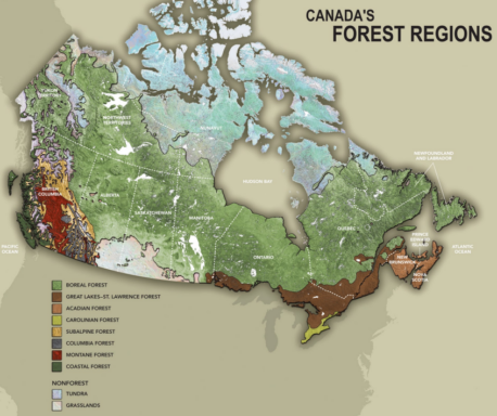
But first, the obligatory shameful look at our cultural history! It’s a sad comment on our society that across Canada forests were once considered nothing but valuable timber commodities, and gruesome logging practices eradicated old-growth forests from coast to coast. In Nova Scotia, PEI, and New Brunswick, the predominant forest type is the Acadian forest – a diverse mix of over 30 native tree species. Today, less than 1% of original old-growth Acadian forest remains, making it one of the rarest forest types in North America. 

The Acadian Forest: Resources for Woodlot Owners

If you’d like to learn more about the various trees of the Acadian Forest, I’ll point you to a fantastic resource that I’ve come across. It’s called “Trees of the Acadian Forest” and it’s a linked PDF that allows you to look up and classify trees based on their characteristics. Whoever took the time to build this is badass – my hat’s off to you. I’ve used it more than once to identify a tree I was unfamiliar with, and it’s quite useful. You can download the file to your phone and use it in areas with no cell coverage.

Another useful resource, if you want to understand the general forest characteristics of an area in Nova Scotia, visit the Provincial Landscape Viewer. Click on the region you want to learn more about, and you’ll see an ecozone label. In my case “210 Cape Breton Highlands”. A quick Google search on that phrase turns up the detailed overview of that region.

An Important Topic for Woodlot Owners: Silviculture

If you’re considering how to manage a woodlot with some care for wildlife and the health of the forest ecosystem, you’re dabbling in silviculture. The US Forest Service defines silviculture as “the art and science of controlling the establishment, growth, composition, health, and quality of forests and woodlands to meet the diverse needs and values of landowners and society such as wildlife habitat, timber, water resources, restoration, and recreation on a sustainable basis.” So, rather than thinking “how much is all this timber worth?” you’re considering a sustainable approach to tending a tree stand, harvesting, and regeneration.

If you’re thinking that all sounds a bit flaky, consider this: there are government support programs with funding available for silviculture treatments. Ah, NOW you’re interested…

Canada Forest Regions

Getting Started with Woodlot Management

A good first step, and a fairly easy one, is simply taking the time to walk your forest and know it well. It’s amazing what you’ll see when you stop and look. A meadow with a lot of new saplings might be new growth replacing an area ravaged by fire years ago, giving new species an opportunity to change the forest composition. You’ll see mature trees dominate light in some areas, leaving room only for their seeds to grow. You’ll notice how one stand of trees changes abruptly to another, and with some practice you can likely spot the landscape factors causing the transition such as shade or soil composition.  

That’s all good, but when you’re ready to get into harvesting practices and regeneration, you may want to call in a professional. I own a 100-acre lot in Cape Breton that is primarily forest, so my approach has been to work with a forester to create a forest management plan for that property, and learn as much as I can so that I can apply some of the practices to smaller parcels of land that I own. 

Joining a Woodlot Owners Association

As a woodlot owner, it can really help if you can leverage the expertise of others to manage your forest. That’s where a Woodlot Association can help. For my property in Cape Breton, I joined the Cape Breton Privateland Partnership (CBPP). For a small annual fee, this association will prepare detailed maps on your woodlot showing species, age, wildlife considerations, and much more. The maps are free, and as a next step you can obtain a forest management plan prepared by a forester for a highly discounted rate. I’ll dive into that later. 

If you’re looking for an association, or just some valuable information to help you manage your woodlot, see the section on resources for woodlot owners in Nova Scotia below.

Getting a Woodlot Assessment Report

Through my woodlot owners association, I can receive woodlot maps and reports, for free! Now, they tend to only offer this service for lots of 10 acres or more. I truly value these reports – for one thing, it will give you extremely high-quality satellite imagery of your property (from GIS mapping tools) with the property boundaries clearly shown. Furthermore, the files are delivered as geo-linked PDF files. Without getting too tech-y, the benefit of this is you can load these files into a free map reading application like Avenza maps, and when you walk the lot you will know your precise location, even when cellular service isn’t available. This has been a game-changer for a guy who has often found himself wandering large lots not entirely sure if I’ve stumbled into the neighbouring lot of a drunken hunter. (Note: I’ve just written a much more detailed guide to creating and using Nova Scotia GIS maps, including property boundaries as defined by the Nova Scotia Property Online registry.

But back to forestry. The woodlot assessment report contains some great information, gathered from forestry databases (not the first-hand observation of a forester – that is covered in a section below). You’ll find tables like this… showing the composition of your forest by age and area.

Basic stand information lets you know the specific species observed on your woodlot.

There is a section for sensitive areas (e.g. water supply zones) and wildlife habitat.

Based on Acadian Forest characteristics, you can explore the most dominant natural disturbance for an area, such as wind, fire, or insects.

The maps really are the best part of the report though. Here’s an example of a map showing forest cover type:

And here’s the same view using satellite imagery:

Creating a Woodlot Management Plan

Once you’ve received a woodlot assessment report, you may want to take the next step, which is engaging a forester to create a forest management plan. Through my woodlot association, I received a discounted price of $500 for creating a plan ($1,200 for non-members). With this service, a forester will walk the lot and provide more detailed documentation on your woodlot, as well as recommendations for sustainable harvesting in the years to come. As you can see from the image above, I own a long and incredibly steep 100-acre lot. Just walking it end-to-end is a workout. I can verify that the forester I hired trudged through the whole thing – he knew all areas of the land very well, with specific details.

The Forest Management Plan included over 45 pages of details on my woodlot – way too much to summarize here. For a sense of what’s included, here is the table of contents:

Let’s get to what I learned from the report. The most valuable section for me was the recommendations. In most cases, the answer is ‘leave it alone and let it grow’. In some zones, there were recommendations for a clear cut, a partial cut, or crop tree harvesting. I have opted to hold off until around 2026 so I can have work done on multiple forest sections at the same time. What’s that worth? It’s in the thousands, but not the 10s of thousands. 

The report also contained some useful information on soil types, threats to the tree species on my lot, and the annual allowable cut (the maximum amount of wood that can be cut off my woodlot in a year). 

The forester walked me through the report in detail, and answered every single question I had. He also informed me about silviculture grants that may be applicable for reforesting after any harvesting is done. All in all, well worth the money spent.

Working with a Forester for Harvesting

As mentioned, I haven’t yet harvested a single tree from my lots, so I’m no expert. But I do have a handy fact sheet from NSWOOA about hiring a contractor. Here are the things they recommend including in a contract:

  • Term: how long the contract is valid for
  • Estimated start date and end-date of operations
  • Property identification: The PIDs for the land
  • Method of Payment: Who is paying whom? This section should also include any estimates or quotes and commitment to meeting budget. If you are receiving payment for your forest products, it should be clear whether it’s lump-sum or a fixed rate based on mill scale. 
  • Proof of liability insurance: including Worker’s Compensation and liability insurance
  • Compliance with regulations: The contractor should agree in writing to comply with applicable laws
  • Signatures: including witnesses
  • Maps: Showing a clearly defined area of operations as well as loading spots, proposed roads, etc.
  • Prescription: It should be very clear what activity is occurring in each forest area, such as clear-cut, selection management, or tree planting.
  • Extent of responsibility: The contract should specify all areas of accountability for the contractor, including harvest, hauling, selling, or post-treatment assessments.
  • Safety Plans: should address any special considerations in treatment areas such as a steep slope, or fire prevention.
  • Post-harvest assessments: After harvest, the site should be inspected to ensure best practices have been followed, and a 2-year inspection post-harvest is also recommended to determine how the forest is responding.

Carbon Offset Programs for Nova Scotia Woodlot Owners

There has been a lot of promise, pilot programs, and scandal surrounding carbon credits. The premise is, woodlot owners opt to let trees grow instead of clear-cutting. This prevents the release of carbon into the environment and helps with global warming as forests are very effective at sequestering carbon. In return, woodlot owners receive carbon credits which have a free-market price (like a stock) that can then be sold.

I follow news in this area closely, and have yet to see a viable option/program for woodlot owners in Nova Scotia. However, this space is changing rapidly so time may change things. If you know of a carbon-credit-based program that Nova Scotia woodlot owners can apply for, please let me know!

Resources for Woodlot Owners in Nova Scotia

Family Forest Network: 11 organizations have networked to provide support to woodland owners. You can find some valuable resources on this site.

Nova Scotia Woodlot Owners and Operators Association (NSWOOA): This association offers resources and a mentorship program for woodlot owners in Nova Scotia.

Nova Scotia Department of Natural Resources and Renewables: Offers a free home-study program to learn the basics of woodlot management.

NSWoods.ca: Find events and conferences for woodlot owners in Nova Scotia

A Final Thought for Nova Scotia Woodlot Owners

One of the most beautiful elements of Nova Scotia are the boundless trees that we see everywhere. It’s easy to take these gentle giants for granted. And of course, people need money to pay bills, and for many, fuel to heat their homes. I’m not advocating a total hands-off approach to forestry – in fact, forests can become healthier through human involvement. It’s simply a matter of taking an informed approach, giving thought to the health of the forest, and what we’ll leave behind for the generations that follow.

When buying land in Nova Scotia, a title search is essential.

Paperwork, right? When what you want is a beautiful slice of Nova Scotia land, who wants to dig through dusty old deeds and legal documents? But as I’ll explain below, a title search is a MUST-DO activity for any prospective land buyer. Let’s dive into why it’s important, and how to get it done. 

What is a Title Search or Land Registry Search?

A title search involves looking up a real estate property to determine important information such as ownership, claims on the property, any rights of way or encumbrances, etc.

Why is a title search important?

A title search is essential because it verifies the identity of the seller, and makes the buyer aware of any claims or restrictions associated with the property. If you’ve ever purchased a home, you’ve done a title search – it would have been completed by your lawyers as part of the sale closing process.


When it comes to buying land, particularly with a private sale, you need to ensure a title search is completed. It can be done as part of the closing process, but I strongly recommend conducting a title search much earlier, basically before any money changes hands.


To point out just a few of the issues that can be spotted through a title search:

  • Owner fraud: A title search tells you exactly who owns the property you’re considering buying. Don’t take ownership on good faith simply because someone is claiming they own a property for sale – a title search gives you certainty from a trusted source.
  • Claims on the property: Just a few weeks ago I was contacted by someone who had made a large deposit on a land parcel through a private sale. There was no purchase and sale agreement in place, and the buyer hadn’t conducted a title search. When I looked up the property in question, it had an “interest” on it. There was an existing mortgage from one of the big 5 Canadian banks. The seller had a home nearby, and all three parcels of land they owned were included as collateral in the mortgage on their home. So what? Well, if the buyer had carried on with payments, while the seller neglected mortgage payments and fell into default, the bank could then legally take possession of all of the land parcels.
  • Rights of way and easements: Many rural land plots in Nova Scotia are accessible only through rights of way established in dated documents that can be tough to decipher. The ultimate question with a land parcel is, can I legally get in and out of it with a vehicle? A title search will reveal the terms of any rights of way that apply to the property.  


When should I do a title search or land registry search?

If you are serious about purchasing a property, it’s best to do the title search as early in the process as possible. Title search fees and services will be included in the closing costs that you would pay to a real estate lawyer, but that step typically takes place at the end of the sale process. Doing a title search early helps you spot any issues that might affect your decision to buy in the first place.


Do I need a lawyer to conduct a title search or land registry search?

No. You can do it yourself if you can Access Nova Scotia’s Property Online (POL) database. It’s an online search tool for finding land ownership and related information associated with a Nova Scotia property. Online access costs over $100 per month, so it’s not for everyone, but you can also buy access for a half day of searches for $6.59 (fees are listed here) by visiting a Nova Scotia land registry office


You may need a lawyer if the title search turns up items that are confusing or unclear. Rights of way can get particularly confusing when the only definition comes from a handwritten deed from decades ago. Fortunately though, most title searches I’ve engaged in generally show what you want to see – a clean and unrestricted title to the land. When that’s the case, the conditions for buying/selling are clear-cut, and your only restriction on the use of the land will be the local zoning bylaws.


What info do you need to conduct a title search?

You’ll typically need one of the following identifiers:

  • Property Identifier (PID#): this is a unique number for each parcel of land in Nova Scotia
  • Assessment Account (AAN): This is the account number associated with a parcel of land’s assessment value and property tax.
  • Owner Name
  • Civic Address: This is tricky with undeveloped land as there won’t be a typical civic address

What information is included in a property title search?

If your search in Property Online (the Nova Scotia land registry database) turns up a result, you’ll see an initial overview page for the property…

Nova Scotia property title search details

Here you’ll find standard information on the property:

  • PID#
  • Type: e.g. Standard Parcel
  • Status: e.g. Active
  • LR Status: NOT LAND REGISTRATION or LAND REGISTRATION. This field indicates if a property has been migrated in the Nova Scotia Land Registry system. For more detail, read our post on how to migrate land in Nova Scotia.

The owner…

  • Name
  • Address

The location…

  • Civic Address
  • County
  • Area: (size, e.g 100 acres)

Assessment value…

  • AAN: You can use the AAN to look up current and historical property taxes on the PVSC website.
  • Value: $(residential, resource). This represents the currently assessed value of the property. For more, read our post on property assessments in Nova Scotia.

From here you have a few options to see more details within Property Online. The “Details” link takes you to more specific information on the property.  You can also click to view a map of the property. While the mapping tool is not as useful as the tools from Viewpoint and RemaxNova, it is THE official record of the dimensions and layout of the property, so it’s worth a look. For the ultimate method of navigating a property and assessing the property boundaries, check out my post on using Nova Scotia GIS maps – it’s the same set of tools that foresters and surveyors use, and with it you can truly never be lost again.


Diving into the Property Online Details

There are a lot of fields on the Property Online details page – too many to list. Instead, I’ll emphasize the ones with the greatest potential impact for a buyer or a seller of Nova Scotia land.


Owner Name: This should match the person you’re intending to buy land from. If there’s a discrepancy, you want to make sure they are entitled to sell and transfer the property. 


Instrument Types:

Deed: There’s a section for instruments (documents) that will often have the most critical information. In it, you should find any deeds associated with the property. The most recent, and therefore most relevant, will be at the top of the list. You can click on the deed to read the details.


Viewing the most recent deed is essential. It will specify the boundaries and dimensions of the property as well as any conditions or easements associated with it. Now here’s the fun part – there’s no single template for deed documents. While they generally follow the same flow and format, there are differences. Older deed documents will be typed or even hand-written, sometimes in a writing style that is hard to decipher.


Registered Interests: If there is a registered interest on the property, it means that a third party (most often a creditor, like a bank) has a claim to ownership based on an agreement. Most often when a registered interest appears, it’s a mortgage lender. You can directly access the mortgage documents, which will let you see when the loan was established, the principal and the rate of interest, and any other conditions on the loan. What you can’t see unfortunately, is how much has been paid off and how much is outstanding. 


In order to sell a plot of land or a subdivided portion that has a mortgage-related interest on it, the seller needs to obtain permission (or a partial release) from the lender. This reduces the collateral for the lender.


Right of way: There are two places you’ll find right of way or easement information associated with a property. In some cases they are unique instruments (documents) that show on the details page. In other cases they are included in the property description within the deed itself. Rights of way are pretty critical for some properties. You don’t want to unknowingly purchase a landlocked property. Many right of way descriptions are vague. Nothing can stir up neighbourly disputes like unclear right of way details. If you’re unsure what rights that right of way includes, it’s best to consult with a Nova Scotia real estate lawyer. One quick example: I have a lakefront property with a deeded right of way through a neighbour’s property. Over the years, trees and brush have grown up over the right of way area. Can I just show up one day with a bulldozer and start tearing through my neighbour’s land? Better ask a lawyer first.   


Easements: Logging companies and utility operators have easements associated with many properties. This gives them the right to access the property based on the terms specified in the document.


Our list is not exhaustive. Sometimes you’ll find something more rare like a covenant, which lays out in specific terms how the land can be used by any future owner. The main point is to avoid surprises. Lastly, if you’re looking for detailed advice on buying land, check out our buyer’s guide called “how to buy land in Nova Scotia” or read our deep dives into taxes on land sales in Nova Scotia, or how to migrate a property.

2023/2024 Tax Rates For All Nova Scotia Municipalities

The various agencies of Nova Scotia do a commendable job of publishing information online for residents to access. The problem is, it’s often not presented well. We’ve waded through obscure apps, bizarre data viewers, and cumbersome data tables to find and surface what most people are looking for in a simple format. 

To that end, here’s your tax rate bud.

Source: data. novascotia.ca (as of Oct. 21, 2024)

We’ve also compiled a full list of Nova Scotia municipal land use bylaws and zoning maps. Also, if tax rates are on your mind, you may be interested in our take on Nova Scotia property assessments. And of course, be sure to check out our comprehensive Buyer’s Guide: How to Buy Land in Nova Scotia. Lastly, if you want to understand all of the type of taxes a Nova Scotia land owner can be subject to, read our post on Taxes on Land Sales in Nova Scotia.


Area Area Type Residential Tax Rate
Commercial Tax Rate
Cape Breton Tax Rates
Cape Breton MUN – Suburban Cape Breton Regional 1.87 4.61636
CITY OF SYDNEY Cape Breton Regional 2.2154 5.556
DOMINION Cape Breton Regional 2.0154 5.084
GLACE BAY Cape Breton Regional 2.0418 5.11
LOUISBOURG Cape Breton Regional 2.0713 5.14
NEW WATERFORD Cape Breton Regional 2.0286 5.097
NORTH SYDNEY Cape Breton Regional 2.054 5.422
SYDNEY MINES Cape Breton Regional 1.939 5.007
Halifax Region Tax Rates
BEDFORD Halifax Regional 1.115 3.553
COUNTY RURAL Halifax Regional 0.968 3.108
COUNTY SUBURBAN Halifax Regional 0.979 3.553
COUNTY URBAN Halifax Regional 1.115 3.553
DARTMOUTH Halifax Regional 1.115 3.533
HALIFAX Halifax Regional 1.115

3.533

HALIFAX URBAN CORE Halifax Regional 1.21

3.29

Queens Region Municipal Tax Rates
LIVERPOOL Region of Queens 1.93 3
QUEENS COUNTY Region of Queens 1.04 2.14
West Hants Municipal Tax Rates
WEST HANTS West Hants Regional Municipality 0.5314 0.98
WINDSOR West Hants Regional Municipality 0.5314 0.98
HANTSPORT West Hants Regional Municipality 0.5314 0.98
All Other Nova Scotia Municipal Tax Rates
ANNAPOLIS Rural Municipality 1.025 1.8
ANTIGONISH Rural Municipality 0.88 1.44
ARGYLE Rural Municipality 1.11 2.29
BARRINGTON Rural Municipality 1.07 2.56
CHESTER Rural Municipality 0.695 1.5
CLARE Rural Municipality 1.04 2.07
COLCHESTER Rural Municipality 0.885 2.28
CUMBERLAND Rural Municipality 1.14 2.71
DIGBY Rural Municipality 1.3 1.85
EAST HANTS Rural Municipality 0.81 2.57
GUYSBOROUGH Rural Municipality 0.77 2.74
INVERNESS Rural Municipality 1.05 1.91
KINGS Rural Municipality 0.853 2.287
LUNENBURG Rural Municipality 0.81 1.957
PICTOU Rural Municipality 0.815 1.825
RICHMOND Rural Municipality 0.85 2.15
SHELBURNE Rural Municipality 1.28 1.85
ST. MARY’S Rural Municipality 0.97 2.28
VICTORIA Rural Municipality 1.22 2.12
WEST HANTS Rural Municipality 1.0323 1.8
YARMOUTH Rural Municipality 1.18 2.17
Tax Rates for Nova Scotia Towns
AMHERST Town 1.67 4.47
ANNAPOLIS ROYAL Town 1.7 3.2
ANTIGONISH Town 1.11 2.63
BERWICK Town 1.578 3.89
BRIDGEWATER Town 1.85 4.07
CLARK’S HARBOUR Town 1.68 5.58
DIGBY Town 1.91 4.2
KENTVILLE Town 1.4262 3.2962
LOCKEPORT Town 2.4 5.41
LUNENBURG Town 1.376 3.358
MAHONE BAY Town 1.324 3.264
NEW GLASGOW Town 1.84 4.45
MIDDLETON Town 1.81 4.29
MULGRAVE Town 1.2375 4.5257
OXFORD Town 1.7874 4.2804
PICTOU Town 1.69 4.34
PORT HAWKESBURY Town 1.58 4.16
SHELBURNE Town 2.01 3.88
STELLARTON Town 1.88 4.3
STEWIACKE Town 1.58 3.45
TRENTON Town 2.04 4.1
TRURO Town 1.9025 4.5475
WESTVILLE Town 2.13 3.95
WOLFVILLE Town 1.4575 3.575
YARMOUTH Town 1.69 4.31

In the early months of each year, all Nova Scotia property owners will receive a mailing from Nova Scotia’s Property Valuation Services Corporation. This is your property assessment notice, and it directly influences the Nova Scotia property tax you will pay in the coming year. Let’s break it down.


How do I ensure my property details are accurate?

At the top right, you’ll see the Assessment Account Number (AAN) for your property. You can use this 8-digit number to view your property details online. This will show property boundaries, any buildings on the land, and prior assessment values. You won’t find much variation from year to year, but it’s important to make sure you’re being assessed for the property you actually own. 


What is the timeframe for the property assessment?

Your assessment reflects your property’s market value as of the first date of the year (e.g. January 1, 2023) and its physical state as of a date late in the year (December 1, 2023 for this year). The gap in between these dates matters. If, for example, you tore down an old house and build a huge mansion during that time period, you may receive an assessment that is much higher than the value of that old house due to the changes you’ve made on the property.


How does the PVSC know the state of my property?

They have an assessor hiding in the bushes watching your property at all times. Just kidding 🙂 Some properties receive a physical visit, resulting in a photograph of your property. You can see these by looking up your property details online using the AANN number. Many properties are simply updated using a set of valuation rules.


Do I have to make a payment?

The property assessment is not a bill, but it will affect one important bill that you receive: your Nova Scotia property tax bill. If your assessment value goes up, you’ll be paying more taxes in the year ahead.


What is the property assessment classification?

Your property will show a “classification” such as RESIDENTIAL TAXABLE, or RESOURCE TAXABLE. If your property has more than one use, you might see multiple classifications. Most properties will fall under these categories:

  • Residential property: single-family residences, multi-family residences, duplexes, apartments and condos, nursing homes, seasonal dwellings, manufactured homes, and vacant residential land.
  • Resource property: Farm property, forest property totaling less than 50,000 acres
  • Commercial property: Property deemed for commercial use, and forest property over 50,000 acres

The determination of residential vs. commercial properties is governed by your local municipal bylaws and zoning maps.


What is a Capped Assessment, and how does it affect Nova Scotia property tax?

A capped assessment places a limit that the taxable assessment for a residential property can increase from year to year. The property must be: 

  • at least 50% owned by a Nova Scotia resident (another drawback for foreign owners). If your residency has changed – say you moved to Nova Scotia and now qualify as a resident, you can notify PVSC using the CAP Notice of Residency form.
  • a residential property with less than four dwelling units or vacant resource property
  • If it’s a condominium, it must be owner-occupied
  • To qualify for the cap the property must be owned for at least a year, or ownership remained within the family. 


When a property is sold, the cap will be removed in the following year unless it is sold to a family member. 


The 2024 Cap rate is 3.2%.


What is the Taxable Assessed Value?

Nova Scotia Property AssessmentThat’s the most important number! That reflects the property value that will determine your Nova Scotia property tax. Unless you have a capped assessment, in which case you’ll pay tax on the lower of the two numbers.


How much Nova Scotia Property Tax will I pay?

That depends on your municipality. They determine their budgets and set tax rates that will cover the costs for municipal services (and possibly some fancy ergonomic keyboards because they’re tired of typing on a cheap old clacker). We created a really long table with all of the municipal tax rates in Nova Scotia for the 2022/2023 year. 


What should I look for in my property assessment history?

You want to check how the assessment value has changed, and how that will impact the Nova Scotia property tax you pay. If it has jumped up substantially, you have an option to appeal.


How do I appeal my Nova Scotia property assessment?

The property assessment you receive has a small form on the back. You can fill it out and mail, email or fax it to PVSC. You MUST do this by the deadline. The current deadline is midnight, February 8, 2024

  • To submit by mail: mail the completed form to Assessment Appeals, 6-15 Arlington Place, Truro, Nova Scotia, B2N 0G9
  • To submit by email: send a scan or a photo of your form to inquiry@pvsc.ca
  • To send by fax: 1-888-339-4555 (within North America) or 1-902-893-6101 (outside North America)


How does the appeal process work?

I have successfully appealed one property, so I’ll use that example here. I submitted the form and within a few weeks I received a call to discuss the details. I guess my claim was considered legit, because it was then passed on to an assessor, who called me about a month later. 


Everything sounded positive. I had a pretty strong case because the property in question had a house on it that was falling apart and non-habitable, but the assessment value was still based on the market value of the home when it was in suitable condition. So, some months went by and I received the paperwork for my new assessment, which was reduced by over $100,000.


There is no cost to appeal, and you do not need a lawyer. Though of course, if you get into some gnarly property issues a Nova Scotia property lawyer may be useful. 

Want more on tax?

If you want to learn more about the full range of taxes a Nova Scotia land owner may be subject to, read our post on Taxes on Land Sales in Nova Scotia.